
Chelsea Neighbors by Parcel
The public record around a Chelsea address is a set of separate sources, each with a different purpose. The official Chelsea tax-parcel layers can show geometry, the situs, owner and mailing fields, fiscal values, building or sale fields, and plan or Registry references. The Suffolk MassLandRecords Registry can then supply recorded ownership instruments. A dated City Clerk street list and library directory can supply historical Chelsea context. No official city tool was found that automatically returns all neighbors as a current person list.
| Source | Block information | Access route |
|---|---|---|
| Chelsea ArcGIS address and boundary layers | Parcel geometry, situs, owner-mailing, value, building, sale, plan, and Registry fields | Free public query or map |
| Vision assessor | Current tax-card values and property fields | Free portal or Assessor Room 211 |
| Suffolk MassLandRecords | Recorded ownership instruments and prior owners for each parcel | Free indexed online search, with older counter fallback |
| Chelsea annual street list | Dated municipal list by street | City Clerk, $15 edition |
| City permits | Address-keyed project, inspection, and status context | Account and portal workflow |
| Chelsea Public Library directories and newspapers | Historical addresses, events, notices, and block continuity | Archive or microfilm access |
| Historic maps and atlases | Block form, lots, and building context | Library and Library of Congress sources |
A parcel owner is not automatically a current occupant, and a mailing address is not the parcel situs. Use each term exactly as the source uses it. The Chelsea address and boundary layers have a 2,000-result maximum, so a block search should rely on map extent or an address filter. Keep parcel IDs in a working list before copying any descriptive field. That makes the Chelsea neighbors result reproducible without turning a map label into a claim about a household.
The Chelsea tax-parcel service directory is the official starting point for a parcel-based Chelsea neighbors search.
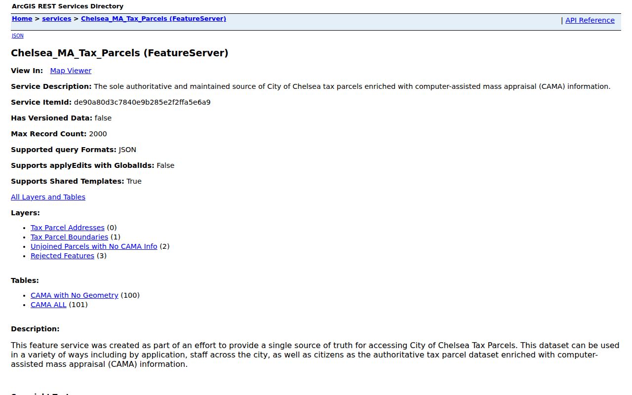
The service separates address, boundary, unjoined, rejected, and CAMA layers, which is useful when one Chelsea parcel does not return a complete match.
Chelsea Neighbor Boundaries
Begin with a verified parcel geometry. In the Chelsea GIS or Chelsea ArcGIS layers, select the target parcel and leave the surrounding boundaries visible. Click each adjoining polygon or address point rather than expanding outward by a guessed radius. Record the parcel ID first, then the public situs, owner, owner mailing address, fiscal year or value, building or sale fields, and plan or Registry reference. The boundary identifies a geographic neighbor, not a social relationship.
Tax geometry has limits. A boundary feature can have no CAMA match, be unjoined, or be a rejected feature. A Chelsea assessor map is also not a legal survey. When a field is blank, check the parcel’s plan or book reference, query the adjacent parcel separately, or ask the city GIS administrator about a documented public layer or data request. Do not fill a gap from an unverified compiled listing.
The Chelsea tax-parcel boundary layer is the source for selecting the adjoining geometry.
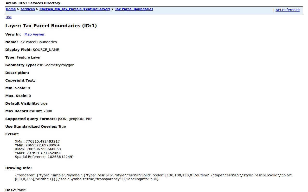
Use visible adjoining polygons to define the Chelsea block study area, then verify any property details in the linked record fields.
Chelsea Neighbor Parcel Fields
The Chelsea ArcGIS schema makes it possible to label a Chelsea neighbors record precisely. SITE_ADDR, ADDR_NUM, and FULL_STR identify the parcel’s situs. OWNER1 and OWN_ADDR describe the recorded owner and tax-mailing contact. MAP_PAR_ID, CAMA_ID, LS_BOOK, LS_PAGE, and REG_ID provide bridges to assessment and recorded-land research. The service sample for a civic parcel confirms that fiscal year is a field of its own, so it should travel with any value or sale reference.
| Field group | What it can establish |
|---|---|
| Situs fields | The parcel location, not proof of every person connected with the building. |
| Owner and mailing fields | The tax-record owner and correspondence contact, which may be elsewhere. |
| Map and CAMA IDs | Identifiers for repeating the parcel search and checking assessment context. |
| Sale and Registry fields | Starting references for recorded instrument research, not proof of a current sale. |
| FY, value, building, and unit fields | Dated assessment and physical-property context. |
The City of Chelsea GIS information page explains the city’s property-location and data-request route. It also notes that custom layers may be reviewed or withheld under the data policy. That is an access limit, not an invitation to guess what a private or missing field might contain.
The Chelsea GIS information and request page provides the documented path when public parcel layers need clarification.
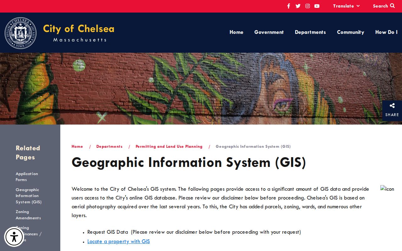
Retaining the layer name, parcel ID, and date makes a Chelsea local block record easier to recheck later.
Note: Keep the parcel’s owner mailing field and situs in separate columns because they can identify different places.
Map a Chelsea Neighbor Block
A careful block method moves from one exact address to the next adjoining parcel. It does not infer a Chelsea building’s people from its owner record or a map symbol. Use the result to understand public property geography, then move to a dated official source when the question is about a particular time. For a broad named-street history, switch to the record chain in the Chelsea street directory rather than stretching a block search beyond its evidence.
- Search the target address in the Chelsea city GIS or ArcGIS address layer and note its
MAP_PAR_IDor other parcel identifier. - Open the Chelsea boundary layer, keep the target visible, and click each physically adjoining parcel one at a time.
- For each Chelsea row, keep
SITE_ADDR,CITY,ZIP,OWNER1, owner-mailing fields,CAMA_ID, fiscal year, sale reference, and source date in separate columns. - Use the Chelsea Registry’s recorded-land search when a deed or plan reference is needed, and return to the original parcel row to avoid merging entries.
- For Chelsea historical context, add the relevant directory year, newspaper date, or map sheet number instead of treating an old reference as current.
MassLandRecords supplies the legal instrument trail, while Chelsea municipal parcel data supplies the tax-map context. If a parcel number is hyphenated or a street name is uncertain, test the source’s own address variants and recorded plan before concluding the result is missing. The public layer supports JSON and pagination, but a smaller address or map-extent query is safer for a street segment.
Note: A parcel next to another parcel is a geographic neighbor only, so keep property evidence separate from claims about personal relationships.
Chelsea Neighbors in Dated Lists
For a dated local list, Chelsea’s City Clerk offers an annual street-list edition for $15. Ask for the edition year and delivery format rather than assuming a live online block roll exists. The annual census and street list are different from the state voter-status form. They answer different questions and each carries its own date. The Chelsea Public Library Historical Archives Guide documents city directories from 1847 to 1995, microfilm from 1847 to 1933, later telephone directories, newspapers, maps, and atlases for earlier block work.
The Massachusetts voter registration search is an individual status check. It requires first name, last name, date-of-birth fields, a five-digit residential ZIP, and an agreement checkbox. It is not a public address roster. M.G.L. c.51 §47C says central-registry names and addresses are not general public records. When a dated local edition is needed, use the City Clerk request route; when historical names need context, use the library’s originals, microfilm, and maps.
Residents can consult the Chelsea elections and precinct information for the city’s election-record and map routes.
The state Chelsea Community Snapshot supplies the documented civic and planning context for the image below.
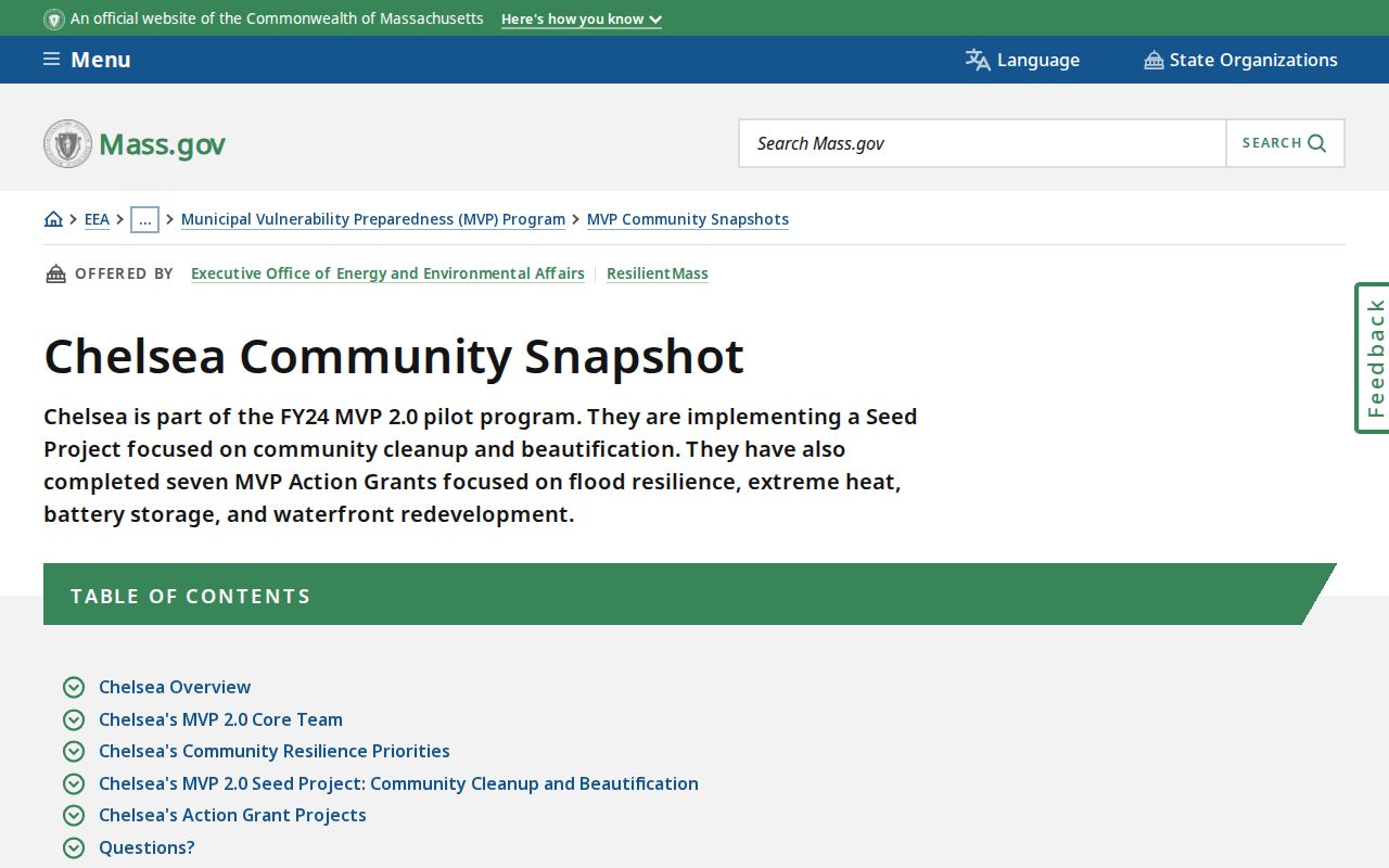
Civic geography can explain a precinct or planning area, but it does not replace the date and access limits of a street-list record.
Chelsea Neighbor Community Contacts
No formal municipal neighborhood-association, HOA, or block-watch roster was found in the official review. Chelsea Pa’Lante is the documented citywide public-engagement umbrella. Its participation route is voluntary and does not create a public member list. The state Chelsea Community Snapshot names several community liaisons in the FY24 resilience work. Those organizations can provide public event, contact, and affiliation context, but none should be treated as a block roster.
Chelsea Pa’Lante
Citywide planning process with public meetings, documents, surveys, and a voluntary get-involved route.
Mystic River Watershed Association
Named as a Chelsea resilience-work community liaison in the state snapshot.
La Colaborativa
Named as a Chelsea resilience-work community liaison in the state snapshot.
GreenRoots
Named as a Chelsea resilience-work community liaison in the state snapshot.
Comunidades Enraizadas CLT
Named as a Chelsea resilience-work community liaison in the state snapshot.
Chelsea Pa’Lante began in January 2025 and had engaged more than 1,200 community members by 2026. The state Chelsea Community Snapshot is the source for the named liaison organizations. The Chelsea Chamber member directory is also a membership-based affiliation list, not proof that a person lives at an address.
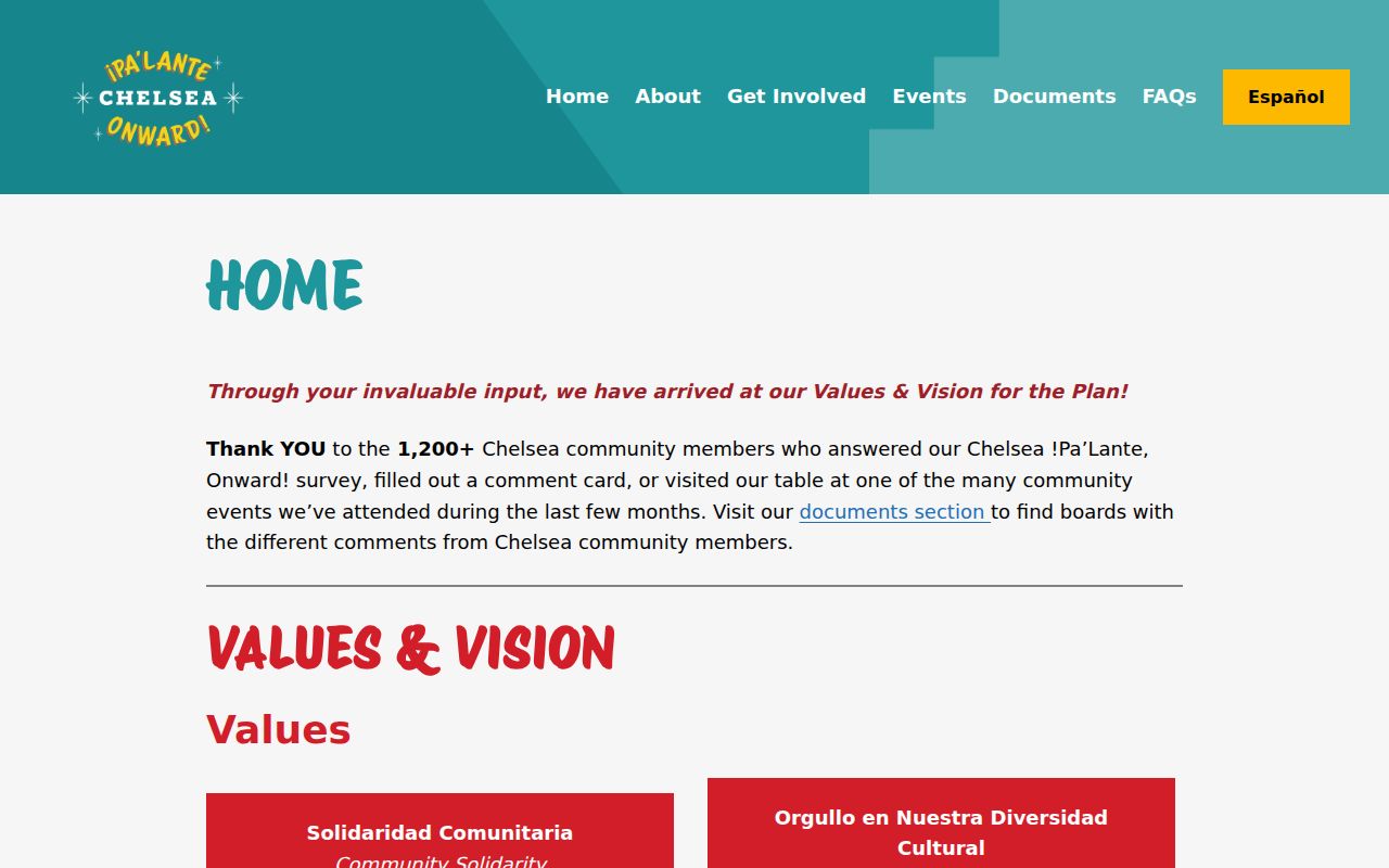
The Chelsea Pa’Lante planning hub shows the community layer available through a public participation route.
Use public organization pages for events and civic context, while leaving membership and address claims to the records that actually publish them.
Note: A public organization contact identifies an affiliation route, not a list of people connected with nearby parcels.
Historic Chelsea Neighbors
For an older Chelsea block, maps and directories add a time layer that current parcel data cannot supply. Chelsea Public Library holds city directories, street indexes, newspaper microfilm, atlases, photographs, and municipal records. The library’s archive guides also point to the 1908 and 1973 fires. Compare the 1908, 1910, and 1912 directory entries with maps, newspaper items, and the current parcel if a number disappears or a building changes. No single fire should be described as destroying all Suffolk land records.
The 1894 Sanborn map is a 38-sheet, public-domain snapshot of building footprint, use, and block context. It is not an occupant list. Chelsea’s dense street geography also requires name care: historic Bellingham Square and Chelsea Square street entries can be tested against adjoining cross streets, map or lot descriptions, and recorded plans. Search surname variants, initials, and diacritics in older indexes, especially when a newspaper or directory spelling differs.
The historic record is most useful when it gives a date, page, map sheet, or source title that can be paired with a parcel or deed reference.
Chelsea Neighbor Privacy Limits
Some block information is not public. The Massachusetts Address Confidentiality Program supplies a substitute address for eligible participants, and confidential voter rules can shield registration information. Court files may be impounded or redacted. Vital records have their own access periods, while DMV, utility, delivery, and private membership data are not public resident records. An absent name may indicate a protected address, a spelling difference, an index gap, a stale layer, or another custodian. It is not evidence that a person is not there.
| Original-source approach | Compiled neighbor category | Why the difference matters |
|---|---|---|
| Parcel, deed, City Clerk, library, or written-record request with a source date | Combined listings assembled from varying public and private inputs | Original records identify the custodian, date, field meaning, and access limit. |
| Blank or protected field remains blank | A stale or same-name match may appear complete | Missing information should not be guessed or reconstructed. |
For a missing online record, contact the responsible office, describe the record class, address, and year, and use the documented access channel. The Massachusetts Address Confidentiality Program and state voter protections must be respected. M.G.L. c.265 §§43 and 43A prohibit stalking and criminal harassment.
Lawful use. Chelsea neighbors research can support personal, family-history, and civic questions, but never use public records to stalk, harass, intimidate, or harm anyone.